 |
| The Road Runner Motel in Gallup, NM |
 |
| Virgie's Restaurant in Gallup, NM |
 |
| The Blue Spruce Lodge in Gallup, NM |
The remainder of New Mexico was only 18 miles, so we found ourselves very quickly in Arizona. Route 66 in Arizona is very interesting.
 |
| Old abandoned bridge in Allantown, NM |
 |
| The Arrowhead Lodge in Gallup, NM |
So basically, we did a lot of interstate driving today, which is nice for making up time, but it doesn't really make you feel like your getting your kicks on route 66. What we ended up doing then multiple times, is drive a piece of interstate, get off the exit to view the town or what was remaining of it, and then get on the interstate again to drive to the next town.
Not much could be seen though driving passed little towns besides some old bridges, some functional, others not, that give away the road once came through here. It is apparent that the bigger cities were the attraction and attended to visitors. We found a couple old bridges in Allantown and Querino as well as Sanders.
 |
| The Painted Desert |
 |
| Boulders at the bottom of Newspaper Rock |
 |
| Close-up of drawings on those boulders |
As we drove the loop in the park, we got to Newspaper Rock, a bunch of big boulders that have hundreds of petroglyphs etched into the stone by the ancient tribe that used to live here. The boulders were way below where we were but when you zoomed in with a binoculars, you could see the many drawings on the rocks.
 |
| The Teepees in the Petrified Forest National Park |
Next in the park, we got to "The Teepees," called like that because of the cone-shaped formation that these hills had. Again I was amazed how the landscape changes so rapidly from the painted desert that we saw, to plains with small bushes, to these amazingly colored cone-shaped hills. The layered blues, purples and grays are created by iron, carbon, manganese and other minerals giving it that color.
About 15 miles into the park, we got see the Petrified Forest, where many pieces of trees were now laying around as pieces of rock. It's amazing how well the shape and character of the tree is preserved in the rock.
 |
| Fallen petrified logs |

What is not understandable to me is how these logs are the way they are. It's like someone chain sawed pieces and then let them turn to rock. We hit another piece in the park called Jasper Forest, that had many pieces of petrified wood on the valley floor, fallen from the rock above where they were once encased but through erosion had fallen down into the valley.
 |
| Largest log in the Petrified Forest National Park |
 |
| Welcome sign at the entrance of Holbrook, NM |
 |
| The Wigwam Motel in Holbrook, NM |
 |
| "Here it is" sign announcing the Jack Rabbit Trading Post |
After that, we drove through Jackrabbit, which houses one of the most famous trading posts along Route 66. Once back in the day, you could find billboards from hundreds of miles away counting down the miles until you got to this trading post. I honestly expected the place to be bigger, even though the sign is pretty impressive.
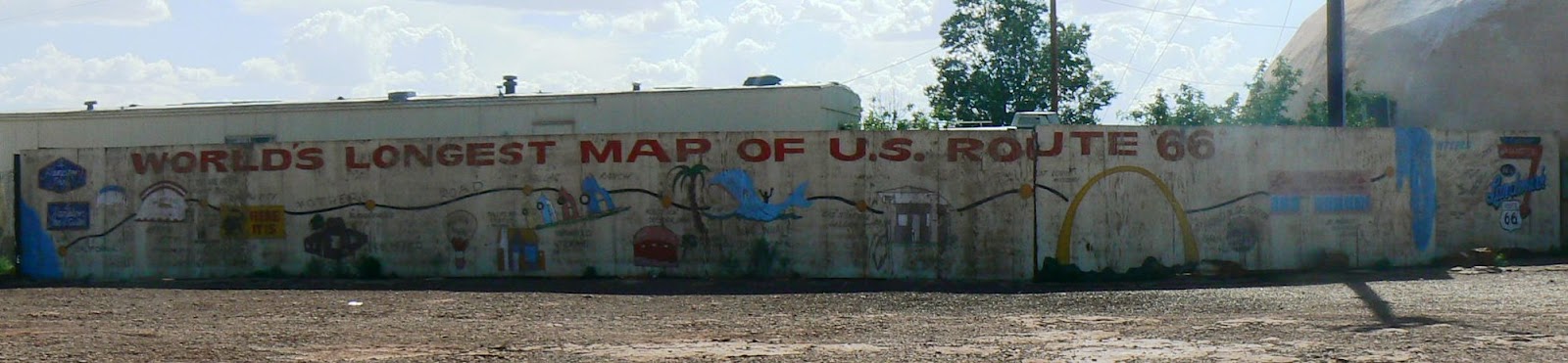
In Meteor City, there was not much there, besides the world's longest map of route 66 as you can see from the picture.
 |
| Ruins of Two Guns, NM |
 |
| Ghost town of Two Guns, NM |
Next, we made it to Two Guns, a ghost town at this point, that had some revitalization about ten years ago, but quickly died again.
What we found close by were many ruins on the edge of Canyon Diablo. The town used to house some gas stations, two roadside zoos and had a cave as well, which we could see way below from one side of the canyon.
 |
| View out the window from one of the ruins at Two Guns, NM |
We were able to make our way to the ruins on the very edge of the canyon and were amazed by how settlers had built up this town around the canyon.
 |
| Twin Arrows, NM |
 |
| Abandoned Trading Post in Twin Arrows, NM |
 |
| 1914 bridge across Canyon Padre |
 While the first 5 miles was a dirt road, it was very manageable to drive. However, the last 2.5 miles were rough on the original blacktop pavement with lots of potholes and pieces out of the road. At several spots, the road was completely gone and replaced with dirt road with tons of rocks.
It took us a while to drive this piece until we got to a certain point where we no longer felt that it was save to continue. So we parked the car and hiked the road for the last half mile around the hills to get a view of the canyon and 1914-bridge. I honestly expected the bridge to be half apart but it was in a nice condition and from what we could tell still driveable. We walked over the bridge and stayed around for a while to take in the quietness and beauty of the canyon.
As we eventually drove off to Flagstaff, we could see ourselves getting closer to Mount Elden, with a top peak of 12,633 ft. As we drove through Winona to get to Flagstaff, we again were amazed by the changing landscape. It is so filled with pine trees and greenery that it honestly feels like the Pacific Northwest.
So even though we hit a lot of interstate today, it was nice to visit some of the areas to observe nature and all its glory.
Miles driven today: 219
Time driven today: 5hrs 45min
Total miles driven: 1,515
Total time driven: 48hrs 20min
No comments:
Post a Comment